Makay Protected Area

The Makay mountain range is located in the south-west of Madagascar, between Mangoky and Beroroha to the south and Malaimbandy to the north. It is about 150 kilometers long; 30 kilometers wide, an area of 400,000 hectares. Administratively, it is located in two districts, Beroroha and Mahabo, in the administrative districts of Atsimo-Andrefana (capital:Tulear) and Menabe (capital: Morondava). The watershed is mainly oriented towards the east, favoring the local population of the Makay zone on this side. The north west of the region is mainly irrigated by the Morondava river which also has its source in the Makay mountain range. Its hydrographic network distributes water throughout the year, and supplies a good part of western Madagascar, especially the Menabe region.
With around 4.000 km2 to cover, Makay is one of the newest protected areas in Madagascar and thanks to the effort of conservation organizations it has its official protective status sinde 2017. This is a great win as Makay is a remarkable place of beauty, home to many exceptional plants and animals endemic to the region and in need of protection as even though the Makay Massif is isolated, it still is threatened by human activity by farmers searching for new sources of food and income. It is therefore essential that the economic situation of the locals improves drastically if we want to protect this amazing natural wonder.
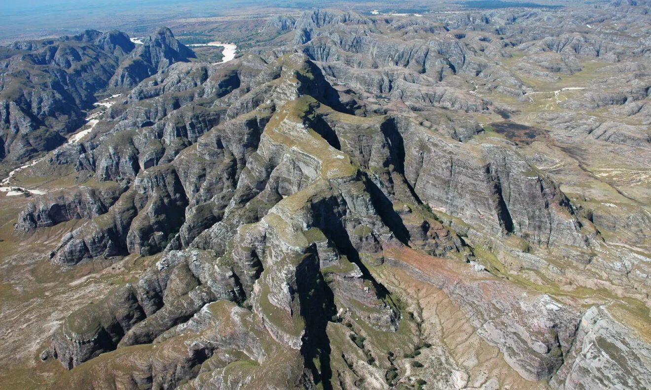
Makay is one of the most isolated regions in Madagascar, far away from the capital and any big cities or any national roads. There are very few villages in the area, meaning we still have a chance to preserve this wonderful land as long as enough effort is made into projects in the region. The simple fact that there are treks organized in the Makay using local porters and guides, already creates jobs and helps the local population realize the importance of this natural site as just like the island of Madagascar as a whole, Makay is a hotspot of biodiversity, with very high rates in endemism, both in terms of flora and fauna.
Makay is the name of the mountain range, but also of the Makay River which flows through the area in the south-west of Madagascar. In the Beroroha district ‘Makay’ refers to the river, in Mahabo it refers to the massif and in Antananarivo it is generally perceived as the new protected area. The Makay River rises at the foot of the Vohibe, which is 1.000 meter high. From there it gullies into the sandstone, creating strange formations and holes and water is stored in pockets of clays from which springs flow. The river leaves in a maze of canyons, digging a little deeper each rainy season, leading to the agricultural plain of Beronono which it irrigates throughout the year.
Thanks to the narrow riverbeds shielded by gigantic walls a subhumid atmosphere is present, allowing dense gallery forest to grow, stabilizing the river banks with their roost. This hydrographic pattern is repeated over the entire eastern and northwestern slopes of the massif, it determines the location of villages and agricultural areas (mainly rice-growing) on the perimeter of the Makay, which benefit from the regular and non-intermittent distribution of water.
Thanks to the massif, humidity is concentrated in its forests and water is stored in clay. This balance depends on the stability of its environment.
Flora And Fauna Of The Makay
The Makay massif has a rich biodiversity with grandiose landscapes and an important plant and animal richness, mostly endemic or even micro-endemic (ahundred new species have been identified in the massif). The region also has a cultural and historical importance as the first cave paintings in Madagascar can be found here.
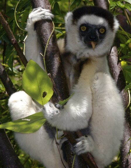
In the last ten years many animal and plant species have been identified. More than a hundred new species have been discovered and many are endemic to Makay. Of the 107 species and subspecies of lemurs present in Madagascar, 10 have been identified in the Makay (3 diurnal and 7 nocturnal), including the Hapalemur, Griseus ranomafanensis, a vulnerable lemur, Verreaux’s Sifaka, a threatened lemur. Twenty different other mammal species have been identified, including 10 bats, with the presence of large colonies of Pteropus rufus and Otomops madagascarensis, and probably a new species of Eliurus.
The Makay also has 11 recorded species of fish (including three endemic and a new species: Pachypanchax sp. Nov.), as well as more than 2,000 species of insects and myriapods (including 80 species of crickets). Among the reptiles, 21 species have been identified, including Crocodilus niloticus, two new species of snakes, known specimens, such as a Lyophidium vaillanti, twice as large as those recorded so far; two new species of lizards (including one gecko), an endangered species (Erymnochelys madagascariensis); as well as chameleons (although in low diversity). We also find many amphibians in the Makay: in 2015 more than three species had been recorded (including two new ones and six others listed for the first time in western Madagascar), especially riparian (and less arboreal and terrestrial) species.
Synonymous with biodiversity at the intraspecific level, we also observe genetic variability in species whose territories are less than a kilometer apart. The Makay also has at least 60 species of birds, including two highly threatened species (the Madagascar crested ibis and the Madagascar Gloreol), while parasitology can count on 50 species of fleas (including one of the potential new species Eliurus and a new species of nematomorpha.)
As far as the flora is concerned, there are three main types of plant formations:
– canyons and gallery forests
– slopes and walls
– plateaus.
Nearly 500 plant species have already been identified, including 38 Pteridophytes (including ferns) and 50 Briophytes (the mosses). About 40 species have been described as new to science. We also find a pepper plant that had not been inventoried since 1924; the most important and soon the only reserve of Ravenea rivularis. The Makay is also Madagascar’s richest in Xerophytes: adapted to dry climates, seven species including two endemic to Makay.
Archeological Sites In Makay
In addition to these flora and fauna characteristics, there are also remains of a few quite exceptional archaeological sites. Many cave paintings (first in Madagascar) have been discovered in several caves (456 in a single site and one charcoal painting dated from the 12th century), which is unique for the whole country. Sites
(caves and rock shelters), such as Mahatiny, Faratsay and Lac Noir, are the most
important. There are also tombs, some of which contain sculpted ornaments and sarcophagi, with numerous ceramic samples observed at all sites.
Heritage Under Threat
This heritage nevertheless appears to be both misunderstood and vulnerable, the authorities responsible for governance of this region ignore this landlocked area. The vast majority of the population is not aware of the vulnerability of this wealth while the ecosystems, as elsewhere in Madagascar are under pressure and subject to numerous direct and indirect threats, both local and international:
– Legal and illegal exploitation of natural resources.
– Hunting of protected animal species.
– Destruction of natural habitats and forest cover by mining, agriculture, bush fires (deliberate and uncontrolled).
– Erosion.
The dependence on water from the populations of farmers/stock breeders around the massif is also an important factor. Around the Makay, there are about 5,000
to 6,000 inhabitants spread over some sixty localities. These localities are part of municipalities whose total population is estimated at 150,000. The density is therefore low and scattered, in a multitude of small villages of less than 500 very isolated inhabitants.

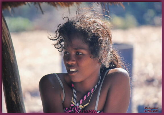
Most of the inhabitants are now mainly of Bara origin, an ethnic group of semi-nomadic pastoralists from the plateaus of southern Madagascar, which live along the Mangoky River, in the north near Beroroha, east of Midongy, and West of the town of Sakaraha. These pastors, turned towards the breeding of zebus, devote a cult to their livestock and their weapons (axes, spears), which provide them with wealth and sustenance. There is also a large number of migrants from neighboring or more distant regions (Betsileo, Merina, Antandroy, etc.).
The surrounding villages are relatively recent: they have only existed since the 1950s and 1960s. This process of sedentarization exerts increasing pressure on these fragile ecosystems. In terms of activity, the population is essentially made up of farmers and herders. Many tracks between the localities can only be taken on foot or by zebu cart. This isolation and the low density of a population that arrived in the region about fifty years ago years explains the fact that the Makay massif has been globally and “naturally” protected until today. Degradation caused by human activities is relatively recent. But this isolation is also a constraint which slows down the development of potential activities in the villages. The policies implemented at the national or regional level have very little impact on villages on the margins of Makay. One of the consequences of isolation is a form of abandonment of this region by state structures and by NGOs for decades. Most of the people in the localities around Makay are illiterate.
If the isolation of Makay has until today relatively preserved from human exploitation, recent threats to forests and wildlife are becoming more and more pressing. The bush fires initiated on the perimeter of the massif are spreading to the forests of the interior, and poaching affects rare and/or threatened species in other areas and who have found refuge here. In order to successfully protect the Makay and retain its
biodiversity, and in particular to make certain prohibitions understandable and acceptable (bush fires and poaching), the local populations would have to
gradually and directly benefit from this protection. This can work through the involvement and participation of the populations in defining the practices of
good management, conservation objectives, thus promoting ownership of the tools and conservation measures.
There have been small initiatives involving ecotourism, beekeeping, construction and rehabilitation of infrastructure (schools and clinics), training of guides and porters, raising awareness of environmental issues, both with the populations of the region and with others, in particular the ecotourists.


